

A billion years ago, the center of North America almost split in half. “It’s amazing that something on this magnitude could re-model the crust of the Earth in the area around Lake Superior and not be able to split the continent wide open,” said G. Randy Keller, a professor emeritus of geophysics at the University of Oklahoma. The history of the Midcontinent Rift is more than an ancient tectonic soap opera, though–it’s a glimpse into the deep forces that move continents, oceans, and the earth beneath our feet.
1. Anatomy of a Giant Scar
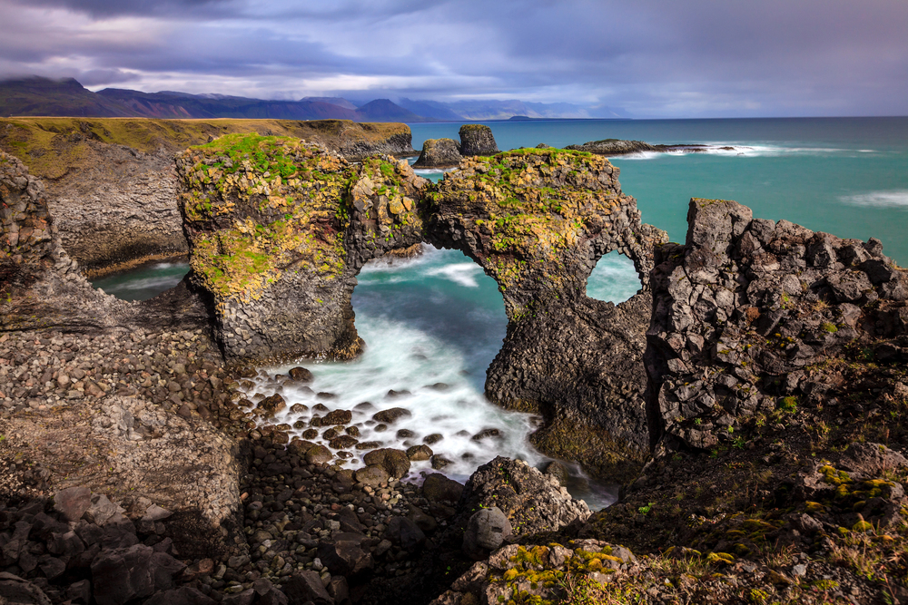
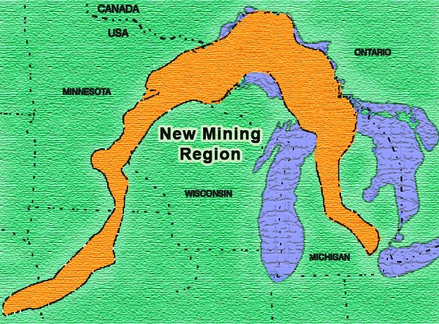
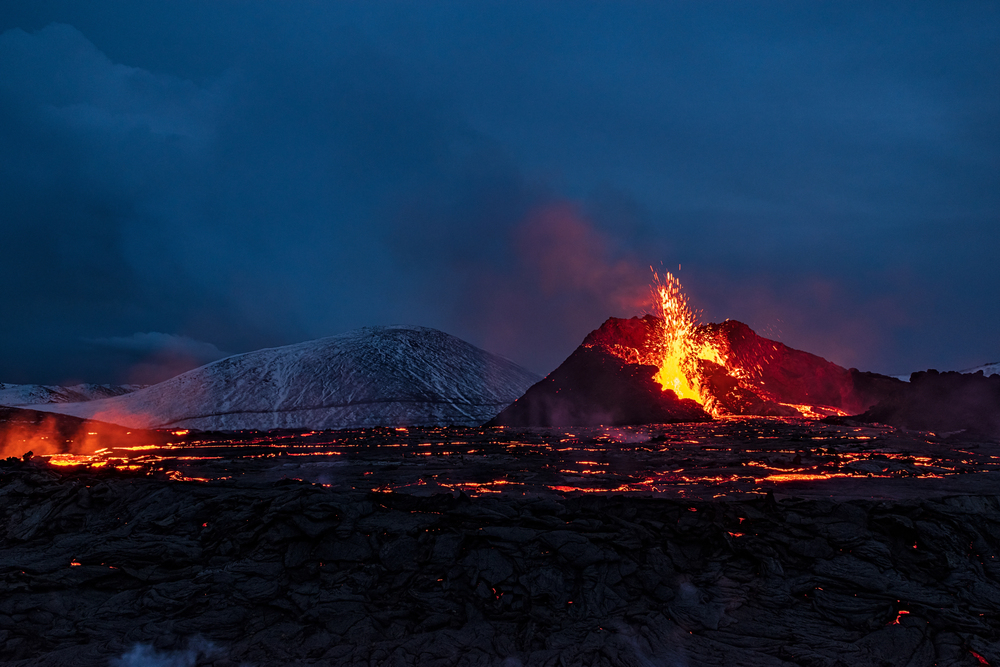
More than 2,000 kilometers wide in a characteristic horseshoe shape, the Midcontinent Rift curves from Kansas north to Lake Superior, then swings southward across Michigan. In its heyday, the basin of the rift was as broad as the contemporary Red Sea, and its geologic imprint is still evident today in the spectacular basalt bluffs along the north shore of Lake Superior. These volcanic stones, which outcrop at such spots as Interstate Park on the Minnesota-Wisconsin border, are remnants of huge flows of magma that once churned through the fractured crust of the rift. Much of the rift, however, is now hidden by deep blankets of sediments, its existence betrayed only by faint gravity anomalies and magnetic signatures revealed by contemporary geophysical surveys. As one researcher explains, the MCR is a “fossilized rift,” a failed experiment in continental rifting seared into the rock.
2. Tectonic Forces and Magma Plumes: Birth of the Rift
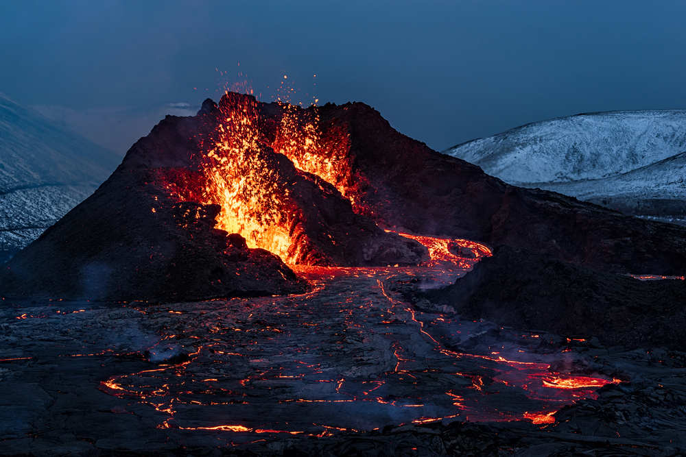
The Midcontinent Rift’s genesis lies in the agitated dynamics of the Earth’s lithosphere. Geologists concur that tectonic forces started to pull apart the ancient continent of Laurentia in roughly opposite directions about 1.1 billion years ago. Extension thinned the crust so that magma could rise from the mantle and erupt as flood basalts, enormous sheets of volcanic rock that are now as much as 20 kilometers thick under the axis of the rift. However, the rift’s record volume of magma has been intriguing scientists. Modeling work shows that passive stretching can’t account for the sheer volume of volcanism.
Rather, evidence suggests a role for a mantle plume, a local upwelling of anomalously hot rock from deep beneath the Earth. “The MCR’s magma volume cannot have been generated by passive upwelling beneath an extending rift,” scientists determined, implicating an uncommon intersection of tectonic extension and plume action.
3. Geophysical Imaging: Looking Beneath the Surface
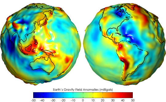
Unveiling the mysteries of the Midcontinent Rift has called for a set of sophisticated geophysical instruments. Gravity surveys indicate a gravity high along the rift due to the heavy volcanic rock filling its central trough. Seismic reflection and tomography have imaged the structure of the rift in detail, never before possible, revealing alternating half-graben fault-defined basins filled with volcanic and sedimentary rocks. The underlying crust is abnormally thick, a combination of rift geometry and a large igneous province. But, amazingly, seismic surveys reveal little hint of residual mantle anomalies under the rift, despite huge volumes of melt being removed in its formation. This lack contradicts speculation as to how mantle processes imprint themselves in the lithosphere.
4. The Rift That Failed: Rival Theories
Although it got off to a dynamic start, the Midcontinent Rift failed to tear the continent apart. A number of theories compete to account for this “spectacular failure.” Other geologists blame the Grenville orogeny, a titanic mountain-building event along Laurentia’s eastern edge for squeezing and eventually stopping the extension of the rift. Others hold that the creation of the new oceanic basin between Laurentia and the Amazonia craton drew off tectonic stress, leaving the rift abandoned. Recent age determinations, however, demonstrate that most compressional faulting took place long after the rifting and volcanism ceased, suggesting that the rift’s demise was more directly tied to the development of seafloor spreading in other areas. The rift was essentially left in the lurch when tectonic priorities elsewhere became more important.
5. Mantle Plumes and the Breakup of Continents: A Wider Context
The Midcontinent Rift system is a prime example of how continental lithosphere can interact with mantle plumes to form giant igneous provinces and abortive rifts. Similarities with other areas, e.g., the Tristan-Gough plume in the South Atlantic, indicate that plume-rift intersections can form thick volcanic crust, generate even microcontinents within oceanic plates. In the MCR instance, the conjunction of a plume and rifting episode yielded one of the most richly magmated abortive rifts on record, approaching the volcanic production of successful continental breakups. As one analysis suggests, the MCR “resulted from a unique combination of a continental rift and a LIP,” a geological hybrid whose inheritance still influences the Midwest.
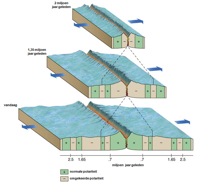
6. Reading the Rocks: Paleomagnetism and Plate Motion
Midcontinent Rift volcanic rocks are not only a history of eruptions, but also a record of the movement of continents. While lava solidified, magnetic minerals followed Earth’s field, recording the changes in the path of Laurentia. High-precision geochronology and paleomagnetism indicate that the continent rapidly shifted from high to low latitudes in the time of rifting, migrating at velocities of over 27 centimeters per year. This “true polar wander” was probably caused by the Keweenawan mantle plume upwelling and related tectonic reorganizations, preparing the ground for the subsequent assembly of the supercontinent Rodinia.

7. The Legacy of the Rift: Economic and Cultural Significance
The geological signature of the Midcontinent Rift has implications extending beyond scholarly interest. The soft sedimentary rocks of the rift could be readily eroded by glaciers, forming Lake Superior and its adjacent scenery. The volcanic rocks of the region are copper-rich, sustaining mining at least since 7,000 years ago, from Native American traders to the mining boom of the 19th century.

Now, the ancient scars of the rift are a bedrock for natural beauty and economic endeavor, reminding us that even geologic failures can make an indelible impression. The Midcontinent Rift is a monument to the restless interior of Earth, a record of forces that can almost, but not quite, divide a continent in half.

