
One of the seismometer stations near Nay Pyi Taw measured ground motion data that were “directly convincing of supershear rupture for the period between the weak, dilational P wave initial arrival and the appearance of big shear offset of the fault,” said Thorne Lay. “That was really clear and convincing evidence of supershear rupture in comparison with other long strike-slip earthquakes on which I have worked.”
1. Supershear Rupture: Physics and Global Context
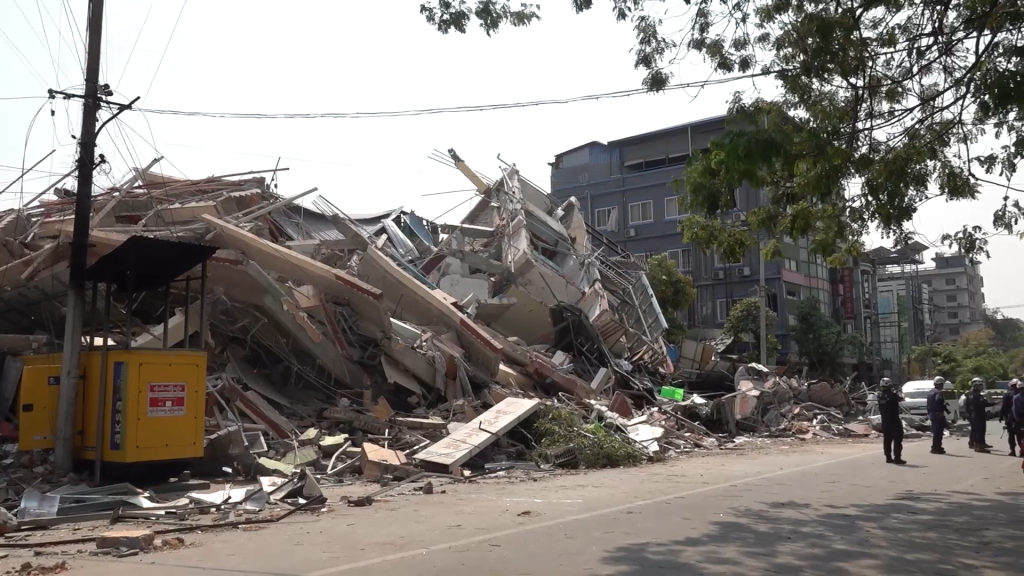
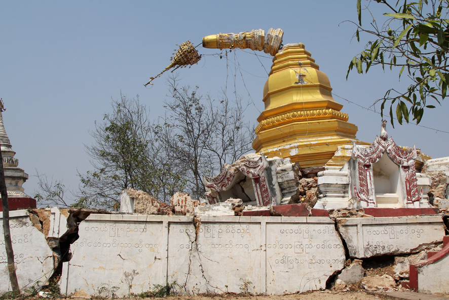
The 2025 Sagaing Fault earthquake, Myanmar, has become a part of the seismology history books as an unusual and dramatic supershear rupture case. With this phenomenon, the rupture front moves faster than the velocity of the shear wave (S-wave), producing a Mach cone of seismic energy like the sonic boom of supersonic planes.

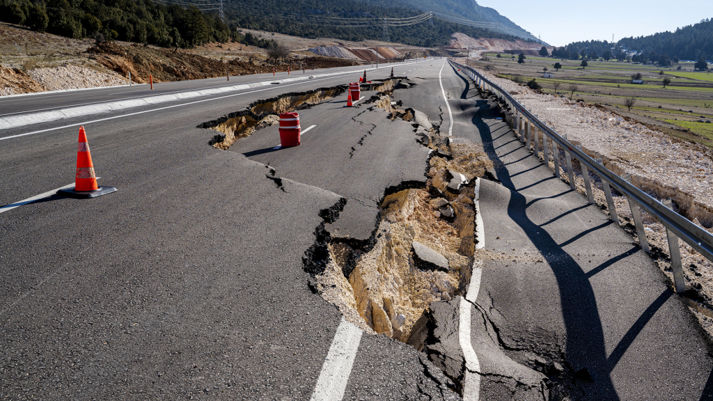
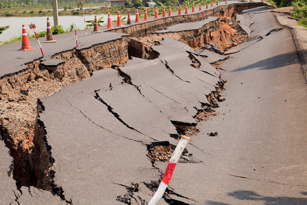
On March 28, rupture velocities on the south segment were 5 to 6 km/s, which is higher than the local S-wave velocity and creating intense ground motions over a large region. Supershear rupture is very rare in giant strike-slip earthquakes all over the world, for example, the 1999 Izmit, 2001 Kunlun, and 2002 Denali earthquakes. In both, supershear rupture was associated with extremely high ground accelerations and widespread damage, produced by the coherent, high-frequency Mach waves radiated by the rupture front.
2. The 2025 Sagaing Fault Rupture: Scale and Slip Distribution
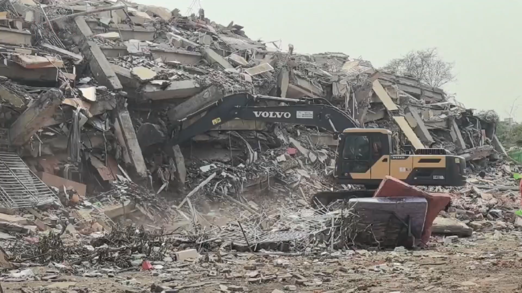
The Myanmar earthquake rupture spanned a record 480 km a strike-slip event seldom matched in length for one of magnitude Mw 7.8. Seismic and satellite (InSAR) modeling revealed a complicated slip pattern: 7 meters of slip was 85 km long north of the epicenter near Mandalay, and patchy 1–6-meter slip defined the south 395 km, with approximately 2 meters near Nay Pyi Taw. This rupture length is either similar to or greater than the 1906 San Francisco and 2002 Denali earthquakes, both benchmark cases for strike-slip faulting. From Antoine et al., the 2025 rupture “defies normal scaling laws between earthquake magnitude, fault length and slip,” underscoring the need for new models in older fault systems.
3. Supershear Directivity and Ground Motion Intensification
The highly directed southward character of the rupture in which seismic energy gets focused in the direction of rupture propagation increased the devastative impact. When the rupture achieved supershear velocity, the highest accelerations and velocities generated by the subsequent Mach waves were at least twice, and up to five times, those generated by ordinary sub-Rayleigh ruptures at 10–30 km from the fault. This was evident from ground motions observed as far as Bangkok, and consistent with theoretical and numerical estimates that emphasized, high-frequency beams of energy with little attenuation over tens of kilometers are generated by supershear ruptures.
4. Fault Geometry, Segmentation, and Seismic Gaps
The geometry of the Sagaing Fault implies a significant role in the rupture propagation. The fault is highly straight for its southern two-thirds, and this aspect nearly definitely enabled the triggering of the prolonged supershear rupture. High-resolution finite-fault models, constrained with seismic and InSAR data, depict heterogeneous dip: 48.5° in the north to rise to 80° in the south (Wang et al., 2025).
The 2025 earthquake ruptured a historic seismic gap between Mandalay and Nay Pyi Taw that had not seen a large earthquake since 1912. “Longer histories and improved knowledge of fault segmentation and geometry are necessary to have any sense of guidance for future event activity,” Lay explained, pointing out the limitations of existing hazard models.
5. Advanced Geodetic and Seismic Imaging Techniques
Characterization of the 2025 rupture was founded on a synthesis approach that synthesized high-rate GPS, InSAR, and dense seismic networks. Such technologies facilitated detailed surface deformation mapping, slip distribution, and rupture kinematics. Both slip magnitude and slip spatial variability were constrained by joint inversion of GPS and InSAR data, while teleseismic P wave backprojection illuminated the bilateral propagation and velocity transitions of the rupture. These methods have become standard in recent major earthquakes, such as the 2023 doublet of Türkiye and the 1999 Izmit earthquake, where remote sensing and geodetic data detected complex, multi-segment ruptures and supershear segments.
6. Implications for Seismic Hazard Assessment of Myanmar
Myanmar’s tectonic setting, which involves the collision between the Indian and Eurasian plates and the right-lateral Sagaing Fault, subjects the country to a high seismic hazard. Probabilistic seismic hazard assessments (PSHA) of the region have been mainly limited by poor fault parameterization and limited ground motion data. The 2025 earthquake points out the importance of accurate fault segmentation, recurrence interval estimation, and directivity and supershear effects that are included in the hazard models (Wang et al., 2014). More recent studies have broken down the Sagaing Fault into five segments varying in hazard levels and identified particularly the Myitkyina–Northern Mandalay segment as very vulnerable to large events in the next 50 years.
7. Towards Improved Earthquake Forecasting and Risk Mitigation
The Sagaing Fault’s performance during 2025 demonstrates an ability of mature, linear fault systems to accommodate extremely long and fast ruptures that contradict conventional scaling relations. Time-dependent hazard modeling, such as data assimilation of geodetic and seismic data, suggests a probable approach to the forecast of large events and their interevent intervals. Numerical model calculations suggest that Mw > 7.5 earthquakes can recur with highly irregular interevent intervals that average 141 years. High-precision geodetic monitoring, paleoseismology, and dynamic rupture modeling will be required to be utilized to improve the accuracy of hazard predictions and aid in Myanmar and similar tectonic environments in planning mitigation.

