
“A year ago, Axial was dormant, but now it’s waking up, and we think it’s going to erupt before the close of 2025,” Oregon State University volcanologist Bill Chadwick stated in reference to increasing enthusiasm among scientists. America’s foundations under their feet are awakening, from the depths of the Pacific to Alaska and the summit of Hawaii. Seismic swarms, lava fountains, and ground deformation have been a daily presence on front pages in recent months, inspiring awe as well as fear.
But what exactly does this volcanic eruption signify? Are we witnessing the start of the opening scenes to some geologic disaster film, or is it only the Earth’s internal rhythm playing out on the main stage? Here, we follow the news at the main volcanoes, the science of eruption prediction, and the bigger picture of America’s place in the seismically volatile Pacific Ring of Fire.
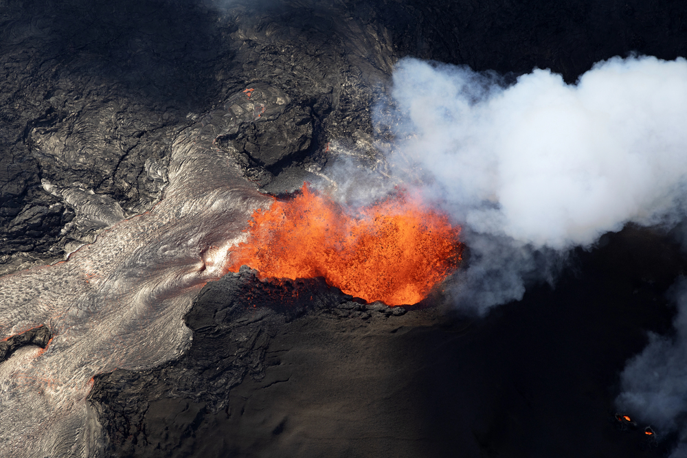
1. Kīlauea’s Episodic Volcanic Eruptions: A Hawaiian Pulse
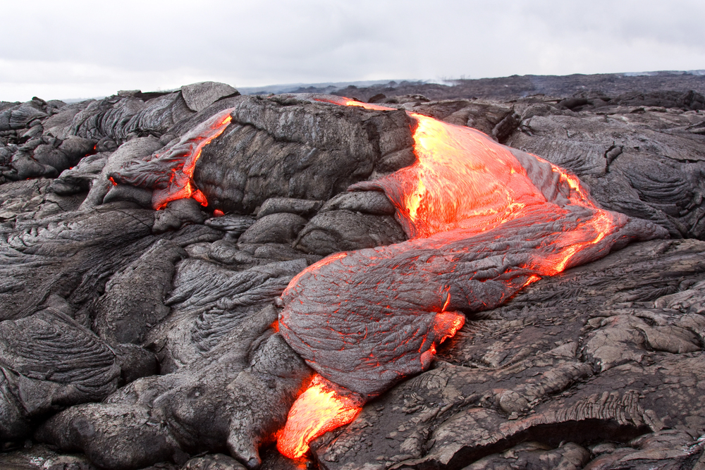
The summit of Kīlauea has been producing a repeating cycle of spectacular, short-lived lava fountaining events since December 2024, the most recent of which closed on July 9, 2025. According to the U.S. Geological Survey, each event is accompanied by rapid deflation as the magma exits, followed by rapid reinflation as the underlying reservoir replenishes. This cycle has been so predictable that scientists now make predictions for the next window of eruption, a technique never before tried in such specificity at Kīlauea.
Hazards remain significant: volcanic gases like sulfur dioxide create vog, irritating eyes and lungs, while fine glassy threads known as Pele’s hair can travel over 10 miles downwind, posing risks to people and water supplies. The ongoing activity is confined within a closed area of Hawai‘i Volcanoes National Park, but the spectacle and hazards are reminders of Kīlauea’s unpredictable temperament.
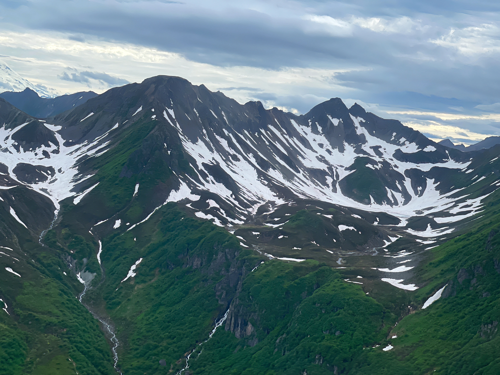
2. Mount Spurr and Alaska’s Awakening Giants
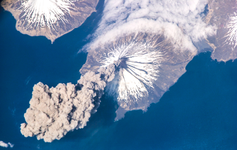
Alaska’s volcanic arc is awakening, and Mount Spurr, which went into a state of dormancy in 1992, is experiencing a rise in seismicity and ground deformation. The Alaska Volcano Observatory elevated the warning to “Advisory,” and computer models say that, if the volcano erupts, ashfall would affect air travel and communities as far away as Anchorage. The 1992 eruption, for example, was so heavy that it blackened the sun and closed the Anchorage airport for nearly a day.
Locals are keeping their eyes on Great Sitkin Volcano, however, as it continues to slowly, steadily pour out lava in the region, and even Mount Iliamna has complained through recent earthquakes. These volcanoes are monitored intensely since they have the potential to spew out airborne ash, which can kill airplane engines and wreak havoc on daily life, a prospect for those living along the northern rim of the Ring of Fire.
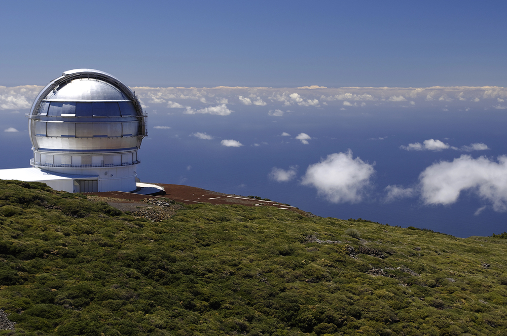
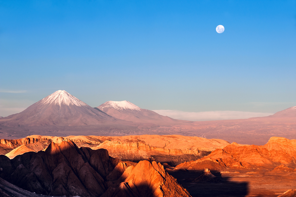
3. Axial Seamount: America’s Most Monitored Underwater Volcano
Far beneath the Pacific, Axial Seamount is slowly growing and creeping toward a boundary that once spurred eruptions. Off the coast of Oregon, 300 miles and 4,500 feet beneath the surface, Axial is the Pacific Northwest’s most frenetic volcano but, as experts point out, not one on a possible tsunami-gigantic scale set to be witnessed by anyone but scientists.
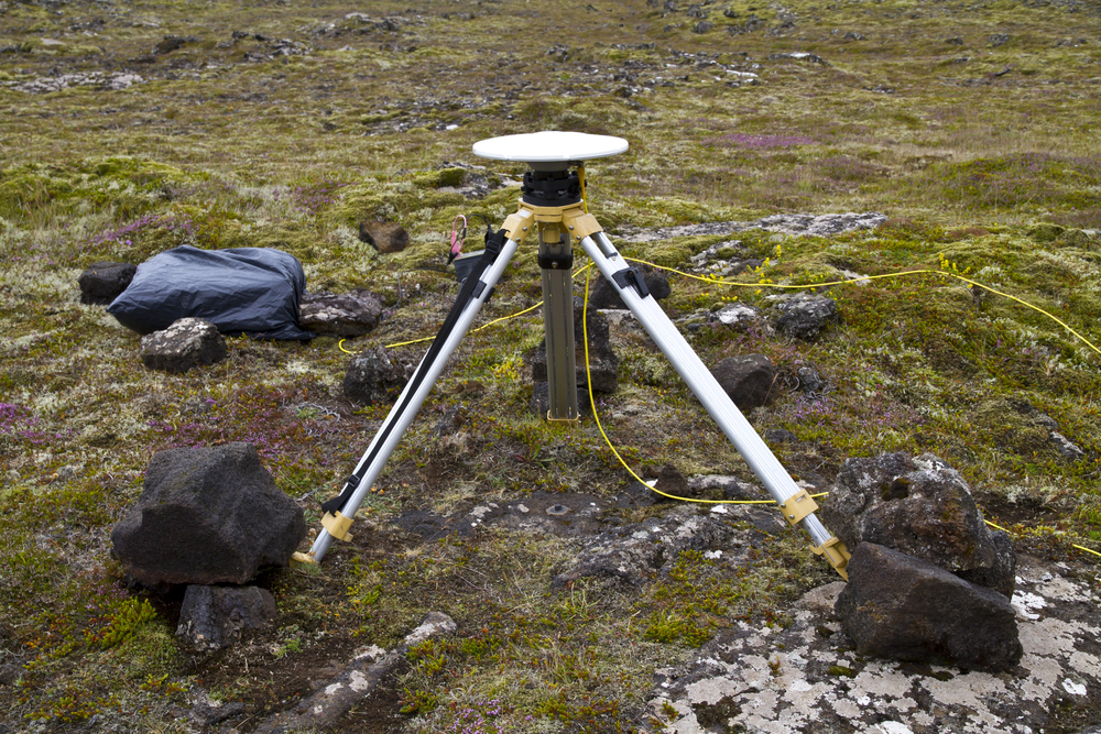
Axial is distinguished by the broad network of sensors that supply real-time information on ground movement in the seafloor and seismic activity. According to Chadwick, “The pressure inside the volcano is building.” It grows so large that a fracture opens and lava pours out of the crack. The 2015 eruption spewed 5.5 billion cubic feet of lava into the globe, and continuing rates of inflation indicate another will occur before 2025 is complete. To researchers, Axial is a natural laboratory where they can test eruption predictions and watch for magma activity in the sea and on the seafloor.
4. The Science and Challenge of Eruption Forecasting
Volcanic eruption prediction remains a sophisticated and difficult science. Scientists at Kīlauea use tilt and GPS measurements to model pressure evolution in the magma chamber and make short-term predictions for lava fountaining activity. Scientists at Axial Seamount use long-term seafloor uplift and seismic histories to predict periods of eruption months or years beforehand. According to the Axial Seamount blog, “Eruptions seem to be prompted at a repeatable inflation stage, but deflation at eruptions, and re-inflation between eruptions, are variable volumes.”
This test has already been partially successful, but the fluidity of inflation rates and the large number of variables make projections subject to change at all times. That being said, the fact that there is potential for forecasting volcanic eruptions, even in approximate time frames, is a giant leap for hazard mitigation and the sciences.
5. America’s Place in the Pacific Ring of Fire
The recent spurt of volcanic eruptions is a stark reminder that the United States lies on the seismically active rim of the Pacific Ring of Fire. The enormous horseshoe-shaped belt encloses 75% of the active volcanoes and 90% of the world’s earthquakes, says National Geographic. The Aleutian Islands of Alaska, the Cascades, and the oceanic volcanoes of the West Coast are all products of tectonic collisions and subductions.
But as the Smithsonian Global Volcanism Program points out, the volcanoes are not part of a consistent system of magma. They each have their own particular geological setting and hazard profile, and local preparedness and surveillance are prioritized.
6. Monitoring Volcanoes: From Satellites to Seafloor Cables
Technology has revolutionized how volcanologists monitor volcanoes, even in remote locations. Satellite networks like NASA’s MODVOLC can detect heat signatures of erupting lava anywhere on our planet in hours, while seafloor cables and pressure sensors at Axial Seamount have access to ground motion and earthquake data in real time.
In Alaska, on-time examination of satellite data is critical to air safety due to explosive eruption ash clouds that are a threat to jet engines and result in flight diversions. In a NASA Earthdata feature, Kenneson Dean of the University of Alaska pointed out that “Large-body jets fly across this region carrying about 2,000 passengers and $1 billion in cargo daily.” It is now crucial to scientific inquiry as well as to public safety to combine satellite and ground observations.
7. Are We Afraid? What the Experts Tell Us
Despite tabloid headlines, most scientists rule out the current string of volcanic eruptions as a sign of doom. Weather.com quotes meteorologist Jonathan Belles as saying that, “Eruptions at one volcano don’t tend to lead to eruptions at another volcano somewhere else in the world. There are dozens of volcanic eruptions that happen or are happening each day, but we don’t notice most of them.”
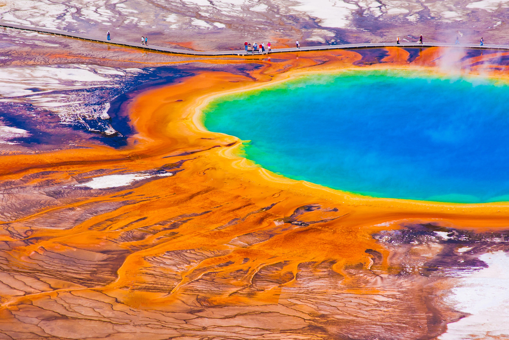
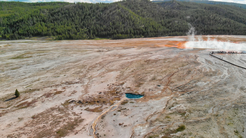
Yellowstone, the usual target of supervolcano terror, remains peaceful with only hints of hydrothermal disruption. The bottom line is not fear but respect: a sense of the risks, staying informed according to official data, and a respect for dynamic forces that shape our landscape.
America’s earth is shaking, all right, but not at random. With sophisticated monitoring and growing understanding of volcanoes, scientists are as well placed as ever to forecast and prepare for eruptions. For those living under the shadow of volcanoes or even who care about the internal workings of the Earth, this is the moment to stay curious, stay informed, and marvel at the enormous forces shaping our planet.

