
A collapsing Arctic mountainside, a confined fjord, and a planet-wide seismic signal do not usually belong in the same chain of cause and effect. In East Greenland, they did. The event is remarkable not only for the height of the wave it produced, but for how that wave changed character.
What began as a violent impact in Dickson Fjord turned into a rhythmic motion that persisted long enough for instruments across the world to register a near-monotone pulse every 92 seconds. The result has become one of the clearest examples of how glacier retreat, steep terrain, ocean geometry, and the solid Earth can interact as a single system.
1. A thaw-weakened slope released a mountain-scale avalanche
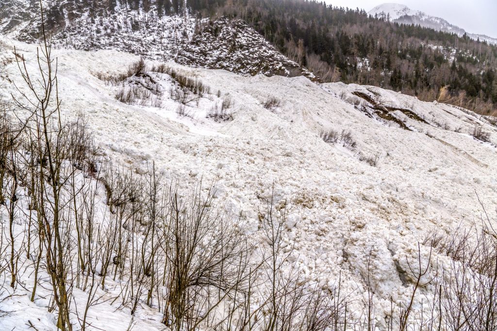
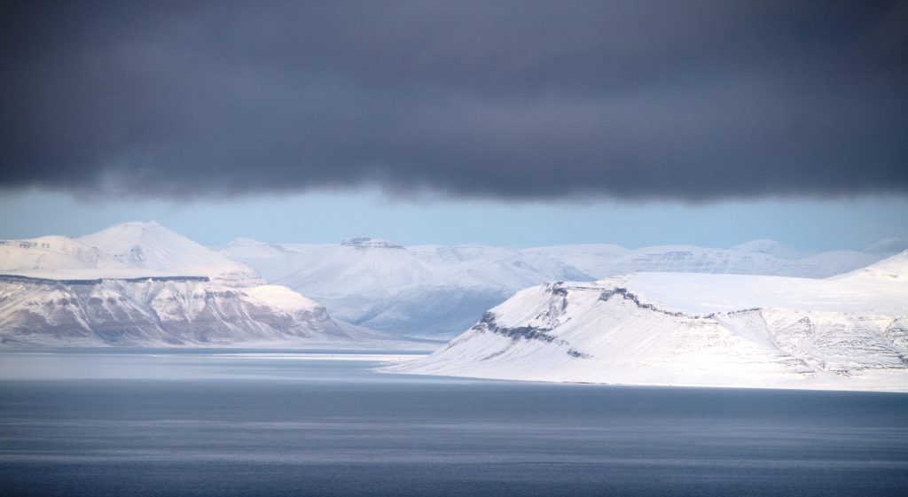
The chain reaction began when about 25 million cubic meters of rock and ice detached from Hvide Støvhorn, roughly 1,200 meters above Dickson Fjord. The descending mass also entrained about 2.2 million cubic meters of glacier ice, which helped reduce friction and increase momentum as it rushed downhill. Researchers tied the collapse to long-term glacier thinning at the base of the slope, a process known as debuttressing. In effect, the mountain lost part of the icy support that had helped hold it in place. The Arctic has been warming rapidly, and the study identified this thinning as the precondition that allowed the slope to fail.

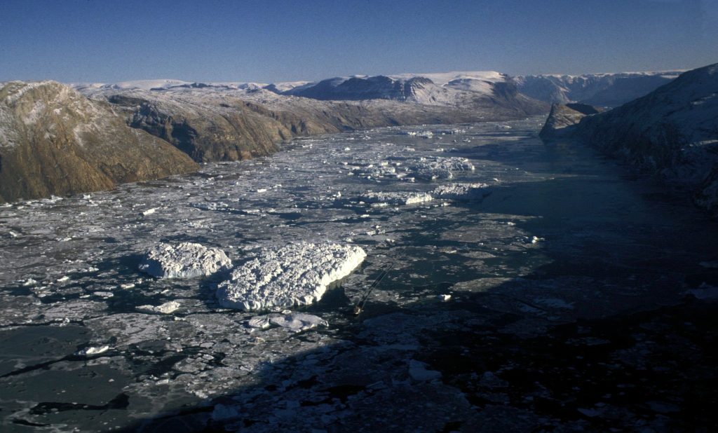
2. The fjord turned the impact into a 650-foot mega-tsunami
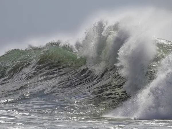
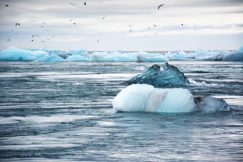
When the avalanche struck the water, it displaced an immense volume almost instantly. The impact produced an initial runup of about 200 meters, or 650 feet, making it one of the tallest wave-generating events documented in recent years. Dickson Fjord’s shape mattered as much as the collapse itself. The fjord is deep, narrow, and bordered by steep, near-parallel walls, which made it unusually efficient at amplifying the surge. Waves up to 110 meters traveled along the fjord, and even 72 kilometers away at Ella Island, the water still rose high enough to damage research infrastructure and erase vulnerable cultural sites.
3. The real mystery was not the tsunami, but the sloshing that followed
Most tsunami energy disperses. Here, much of it stayed trapped. Inside the fjord, the water settled into a standing wave called a seiche, oscillating back and forth like water in a long basin. Simulations showed the motion stabilized into a roughly 7-meter seiche with a period close to 90 seconds. That steady side-to-side transfer of mass kept pushing on the fjord walls and floor, turning a brief catastrophe into a long-lived geophysical signal.

4. Seismometers worldwide recorded a pulse that behaved unlike an earthquake
The global signal had a dominant frequency of 10.88 millihertz, corresponding to a 92-second period, and it endured for up to nine days. That is far outside the normal behavior of earthquake signals, which typically contain a richer mix of frequencies and fade much faster. Scientists found that the radiation pattern also matched the fjord geometry. Rayleigh waves were strongest perpendicular to the fjord, while Love waves aligned along its axis, consistent with the idea that the moving water body was acting like a horizontal force source. The Earth was not ringing because of a deep tectonic rupture. It was responding to water repeatedly shifting inside a narrow Arctic basin.

5. A new satellite finally captured evidence of the hidden wave motion
For months, the seiche remained the leading explanation, but direct confirmation was missing. That changed with data from NASA’s SWOT satellite, whose Ka-band Radar Interferometer can map water surfaces across a broad swath instead of sampling only a narrow line beneath the spacecraft. Those passes revealed the water surface inside Dickson Fjord tilted from one side to the other, with differences reaching about 1 to 2 meters. Researchers compared the satellite maps with reconstructions of local conditions and ruled out weather-driven explanations. In a published conclusion, the team wrote, “Based on the seismic attribution, and systematic ruling out of other dynamic phenomena, we conclude that the observed variability in the SWOT data is consistent with that of a slowly decaying seiche.”
6. The fjord’s geometry explains why the signal lasted so long
Longevity was the unusual feature. Seiches are well known, but a free oscillation lasting days at this period had not been documented this way before. The most likely reason was confinement.

Numerical models showed that the fjord’s central segment retained much of the wave energy, while a sharp bend and limited exchange with the outer fjord reduced leakage. That allowed the oscillation to decay very slowly instead of collapsing within hours. The study’s modeled damping closely matched the recorded seismic decay, strengthening the case that the trapped water motion was the source.
7. The event also exposed gaps in Arctic hazard monitoring
This part of East Greenland had not previously been known for tsunamigenic slope failures of this scale. Yet the same gully appears to have produced several smaller events since 2016, including at least one later signal in October 2023 from the same source region. The case has sharpened interest in high-sampling-rate sea-level sensors in confined basins, improved bathymetry, and real-time integration of seismic and satellite data. Cruise traffic passes through nearby waters in the ice-free season, and similar steep-walled fjords exist in Alaska, Norway, Canada, and elsewhere in Greenland.
The engineering lesson is broad: in remote polar landscapes, changing ice conditions can reshape slope stability, and a local collapse can create signals and hazards that extend far beyond the shoreline. Dickson Fjord did not produce only a towering wave. It revealed a mechanism by which climate-shaped terrain, trapped water, and the rocky crust can couple into a single, measurable phenomenon. That is why the event remains so important. It was not just a tsunami, and not just a landslide, but a rare demonstration that a remote fjord can force the whole planet to register its motion.

