
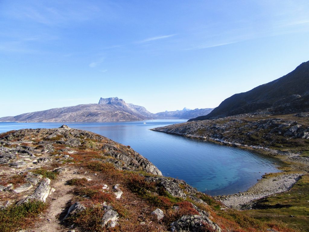
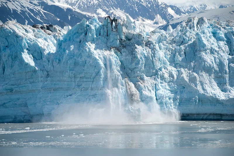
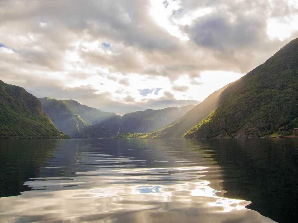
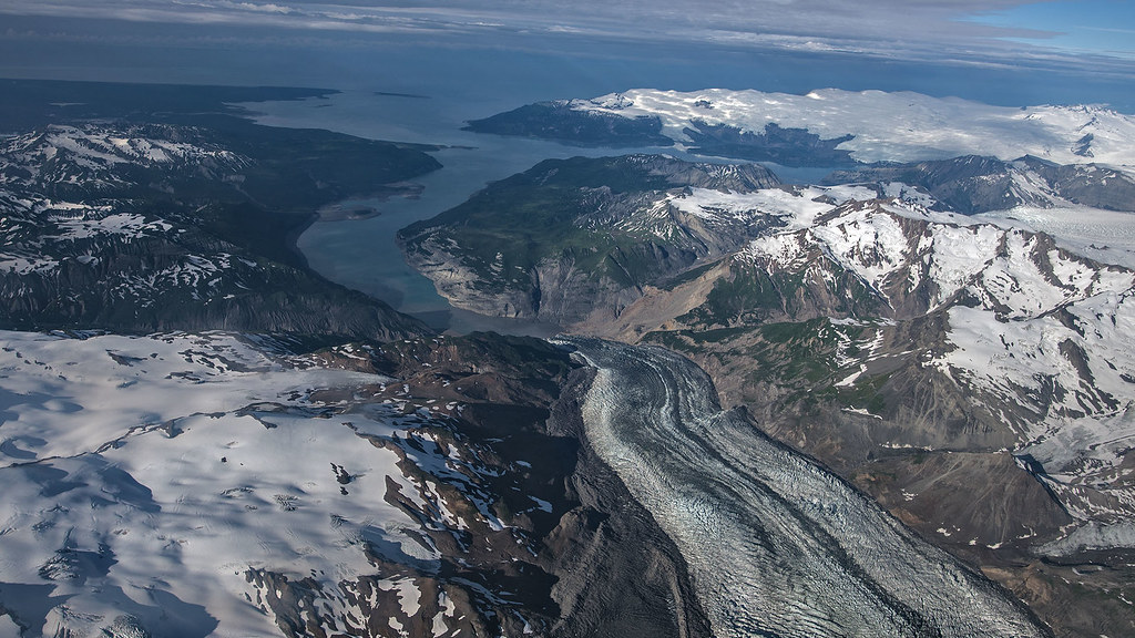
In Greenland’s remote fjords, some of the most consequential hazards are not announced by crowded coastlines or constant monitoring. They begin high on steep rock walls, where thinning glacier ice and shifting frozen ground can remove the support that once held entire slopes in place.
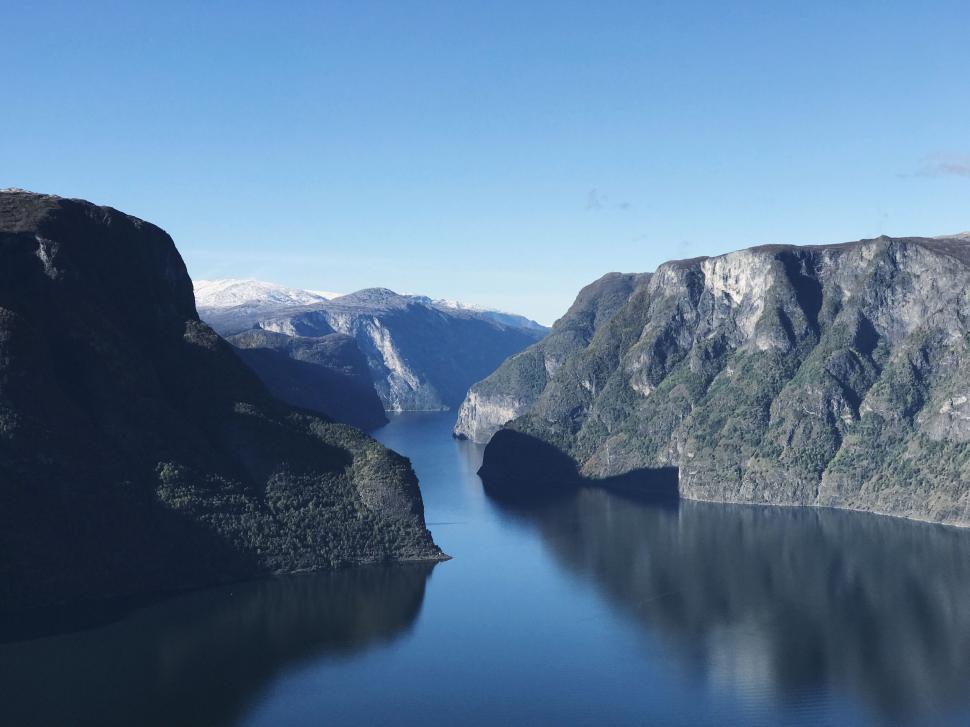
The result is not only a landslide problem. In narrow Arctic fjords, a collapsing mountainside can turn instantly into a water-displacement problem, a coastal inundation problem, and, in rare cases, a long-duration basin resonance problem. The Dickson Fjord event in East Greenland revealed how these systems can combine into a hazard chain that deserves much closer engineering and scientific attention.
1. Glacier retreat is removing structural support from unstable slopes
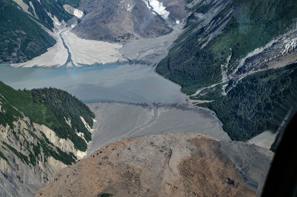
The Greenland case was not treated by researchers as an isolated rockfall. It was linked to glacial debuttressing, a process in which thinning ice no longer braces the rock mass above it. In Dickson Fjord, researchers concluded that glacial thinning induced the rock-ice avalanche that began the hazard cascade. That matters because Greenland contains many steep coastal mountains directly above deep water. When glacier margins retreat in these settings, the loss of support can turn long-developing slope instability into sudden failure. The engineering implication is straightforward: terrain that once appeared mechanically buttressed by ice cannot be assessed using older assumptions about slope stability.
2. A landslide into a fjord can generate a tsunami almost instantly
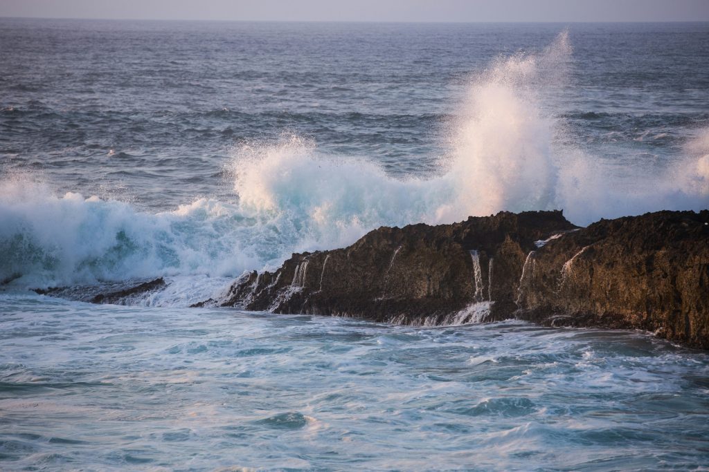
On September 16, 2023, a rockslide of roughly 25 million cubic meters entered Dickson Fjord and triggered a tsunami up to 200 meters high near the impact zone. The initial wave was extreme because the collapse entered a confined, deep basin rather than an open shoreline. Fjords amplify this danger. Their steep walls, narrow widths, and great depths give displaced water little room to spread. Instead of dissipating quickly, the water can surge upward, rebound, and continue propagating along the basin. That makes local topography just as important as slide volume when evaluating hazard potential.
3. Narrow fjords can trap wave energy instead of releasing it
The most unusual part of the Dickson Fjord event came after the initial impact. Modeling showed that the tsunami stabilized into a slowly decaying seiche about 7 meters high, with water sloshing across the fjord at a period of roughly 90 seconds. This was not a conventional open-water tsunami scenario. The geometry of the fjord acted like a basin tuned to a natural oscillation mode, allowing wave energy to remain trapped for far longer than many hazard models would assume. In practical terms, the first wave is not always the end of the event. In a confined Arctic basin, the water body itself can become a persistent resonator.
4. These hazards can reach far beyond the collapse site
The destructive zone was not limited to the immediate impact area. Observed runup extended tens of kilometers away, and damage was recorded at Ella Ø, about 72 kilometers from the source area. Even where wave heights were far smaller than near the landslide, the surge still inundated shorelines and damaged infrastructure. That reach is a reminder that remote does not mean localized. Research stations, heritage sites, seasonal marine routes, and shoreline installations can all sit inside downstream hazard corridors. For infrastructure planning, the relevant map is not only the unstable slope itself, but the entire fjord system connected to it.
5. Remote Arctic hazards are becoming easier to detect from afar
One reason the Dickson Fjord event drew global attention is that it generated a seismic signal detectable worldwide for nine days. At first, the signal puzzled scientists because it did not resemble an ordinary earthquake. It appeared as a stable, monochromatic pulse repeating roughly every 92 seconds. That discovery expands the monitoring toolkit. Landslides, tsunamis, and basin oscillations in remote fjords can leave signatures in seismic and infrasound networks far beyond Greenland. For regions where conventional coastal instrumentation is sparse, Earth itself becomes part of the sensing system.
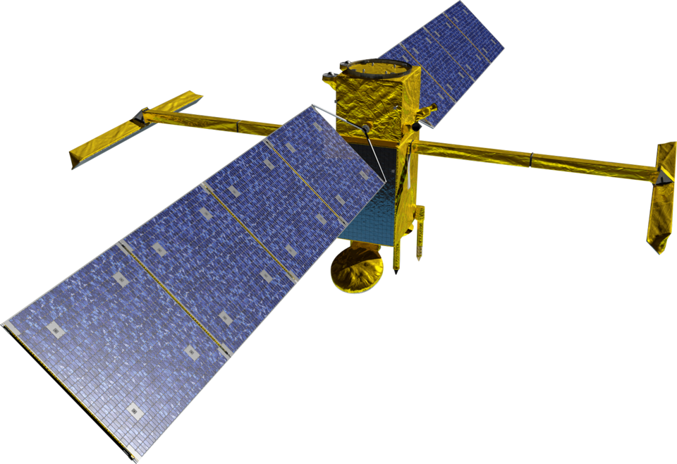
6. New satellite systems are finally observing the hidden wave motion directly
For months, the standing-wave explanation rested heavily on modeling and seismic interpretation. Later work using the SWOT satellite provided direct observational support by mapping water-surface slopes across the fjord. According to the analysis, cross-channel height differences of up to two meters reversed direction as the water moved back and forth.
This is a significant step for hazard science in hard-to-instrument places. Traditional altimeters struggled with narrow fjords, but wide-swath measurements are beginning to capture water-level structure in places where gauges are sparse, undersampled, or absent. That creates a clearer path toward verifying models rather than relying on reconstruction alone.
7. Greenland’s risk is a cascade problem, not a single-event problem
The Dickson Fjord case linked the cryosphere, the rock slope, the water body, and the solid Earth in one chain. Glacier thinning helped prepare the slope, the slope collapse generated the tsunami, the fjord geometry prolonged the hazard through resonance, and the oscillation transmitted energy into the crust as a global seismic pulse. That sequence is what makes the event important beyond one fjord. It shows that Arctic hazard assessment can no longer separate slope failure, coastal flooding, and remote sensing into isolated categories.
The system behaves as a connected machine, and the failure of one component can activate several others in rapid succession. Scientists are paying closer attention because the Dickson Fjord event was not just spectacular; it was measurable across multiple systems at once. It exposed how Greenland’s changing fjords can generate hazards that are easy to miss locally but impossible to ignore once the full chain is reconstructed. For engineering, monitoring, and risk mapping, the lesson is clear. In Greenland’s steep coastal basins, the critical question is no longer whether a slope can fail, but what the fjord will do with that failure after it reaches the water.

