")
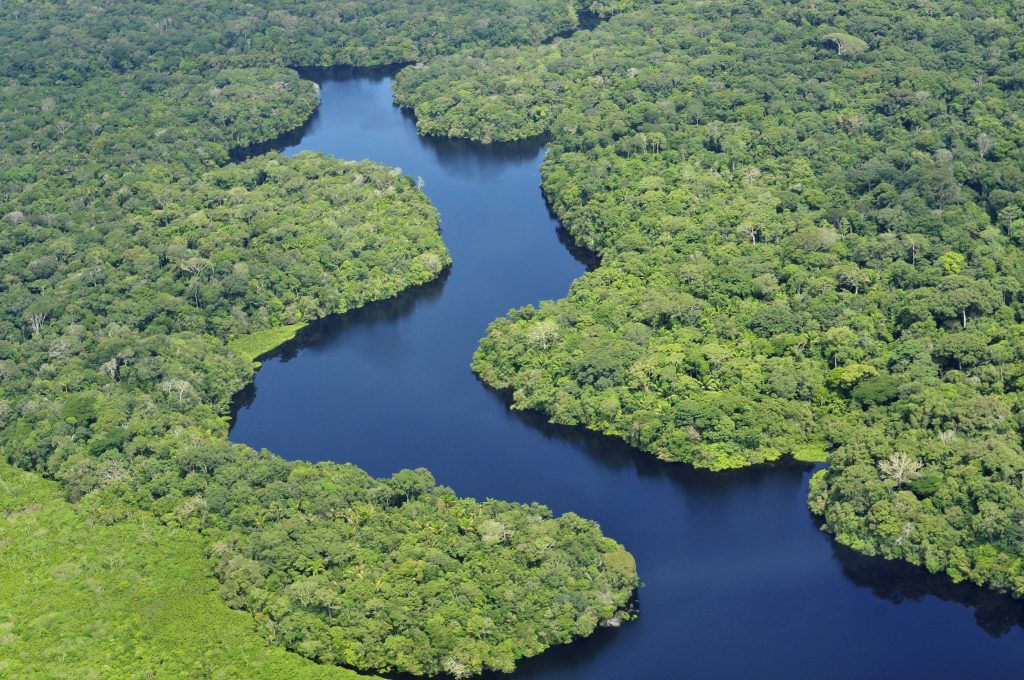
The Amazon is sometimes said to be an ecosystem which is resistant to the permanent construction, wet, acidic, and eager to reclaim any structure constructed of wood, clay, or thatch. However, an increasingly accumulating fieldwork and remote sensing continues to reveal an alternative fact: purposeful landscapes being constructed to accommodate settlement, food security and movement at scales difficult to view on the ground.
The difference that alters the dialogue is not a spectacular object, but congruency of signs, geometry under canopy, soils that are not natural rainforest earth, water systems that deal with flood and drought as design possibilities, not disasters.
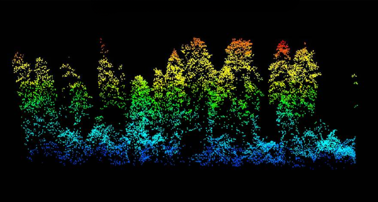
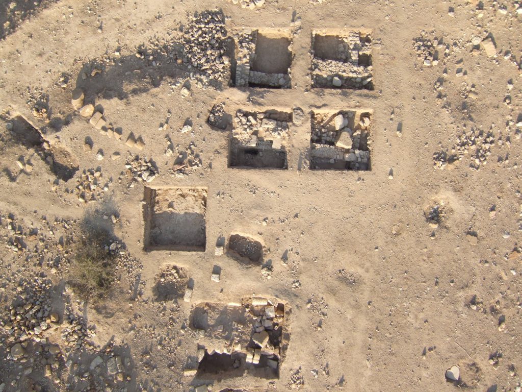
1. Lidar is turning “empty forest” into mapped infrastructure
The most efficient method of separating vegetation and terrain in an area where most ancient buildings were constructed of earth formations as opposed to stone has become airborne mapping. In analyses that cut across the Amazon as a whole, relying on multiple datasets, scholars have found indicators that there are actually 10,000 to 24,000 pre-Columbian earthworks in the Amazon River basin, which re-orders the rainforest as a site of repetitive, systematic construction, as opposed to a space of discontinuous bursts of settlement. The fundamental change is the methodological one: in case the terrain can be digitally deforested, roads, ditches, platforms, and geometric enclosures are represented as engineered forms, rather than indistinct heaps. It has an implication on the history of engineering. Large-area sensing does not simply have the sites that can be found more quickly; it is displaying layouts that were planned and will only be comprehensible as networks of corridors, nodes and water-control features that were probably working together.
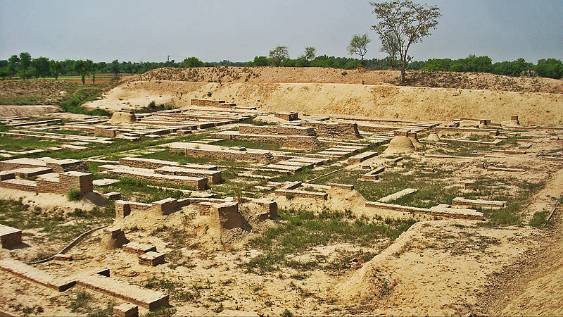
2. Grid-planned rainforest centers show urban design, not improvisation
Ordered geometry: repeated platforms, marketplaces, webs of roads, which connect a number of population centers with each other, were some of the most visibly striking lidar-verified settlements in existence. Researchers reported in the Upano Valley of Ecuador a gardened metropolis which had over 6,000 earthen platforms in a geometrical pattern and interrelated by a fine mesh of roads that connected many centres. This scale of design implies surveying, common standards and coordinate work, necessities well-known to the modern planner, yet seldom given credit to the societies of the tropical forest in the older history. In contrast to the stone cities that announce themselves by ruins, earthworks must be interpreted, with patterns: straight lines where rivers do not require them, repeated right angles, and roads, which continue over the landscape. The value in engineering is the consistency-proof of intent.
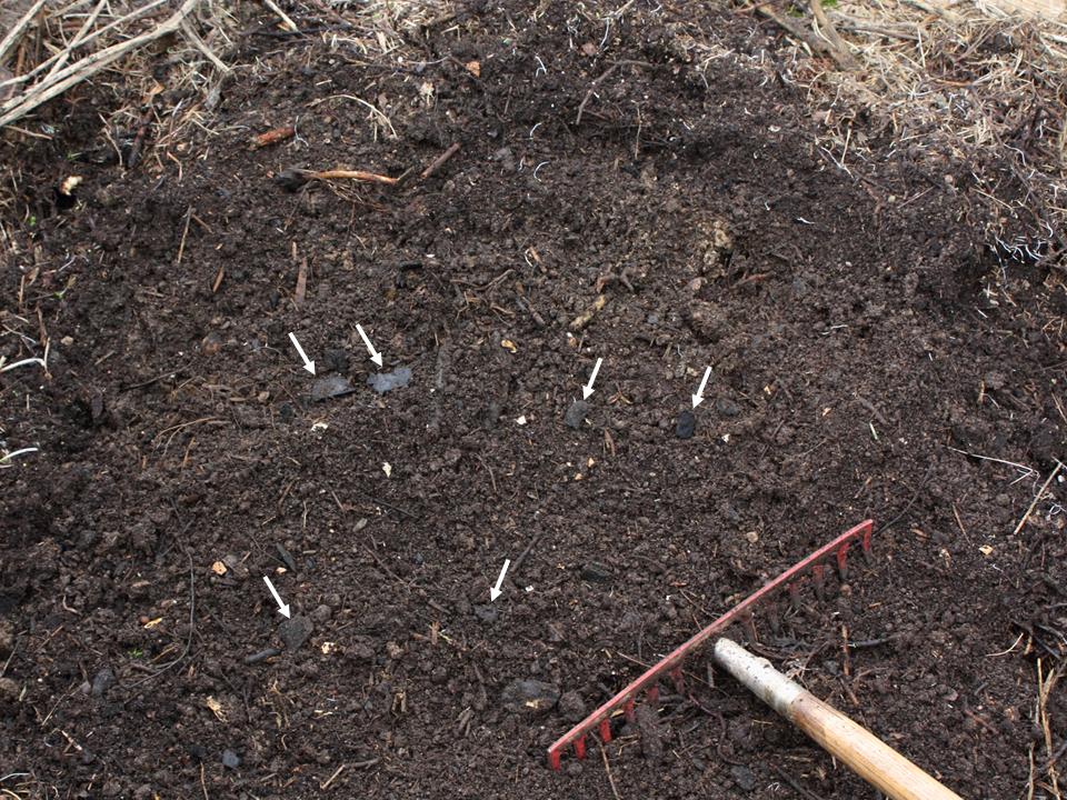
3. “Dark earth” behaves like a manufactured material
Fertility cannot be assumed in lots of areas in Amazon, where extensive rains and drained soil oppose the practice of agriculture in the long-run. However, large regions have human-made soils that have been referred to as terra preta, or earth of the dark, rich, fertile soils created by human activity through sustained human activity in the form of organic waste and char. Accoring to the research that is summarized in recent syntheses, terra preta regions occupy about 154,000 square kilometers of the basin, meaning that soil improvement is a distributed technology, not a local trick. This reminds the environmental designers and engineers that materials can be ecological. The role of soil in these contexts is more that of infrastructure- constructed, sustained, and able to sustain high densities of communities in which standard models would project a lack of resource.
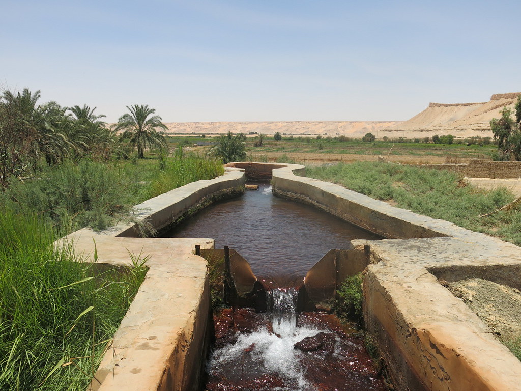
4. Water systems were designed for both extremes flood and drought
The Casarabe society of the seasonally flooded Llanos de Moxos where long dry periods are also common adopted a dual system that viewed water as something to channel, store and plan. Research gives accounts of long drainage canals which relocated the extraneous water off the fields during the rainy months alongside farm ponds that acted as reservoirs in lean months. The outcome was not only a reduction in the risk but a production that would be sustained at least with two harvests of maize yearly. That two-sidedness, drain when it (drain) is saturated, store when it is scarce, is similar to modern stormwater strategies, except that it relies on local earthmoving, shallow hydraulics, and landscape-sized planning. Field evidence is supported by the system such as microbotanical work; one study references a study of 178 phytolith and pollen samples of a farm pond to identify the presence of maize as well as highlighting the centrality of the diet.
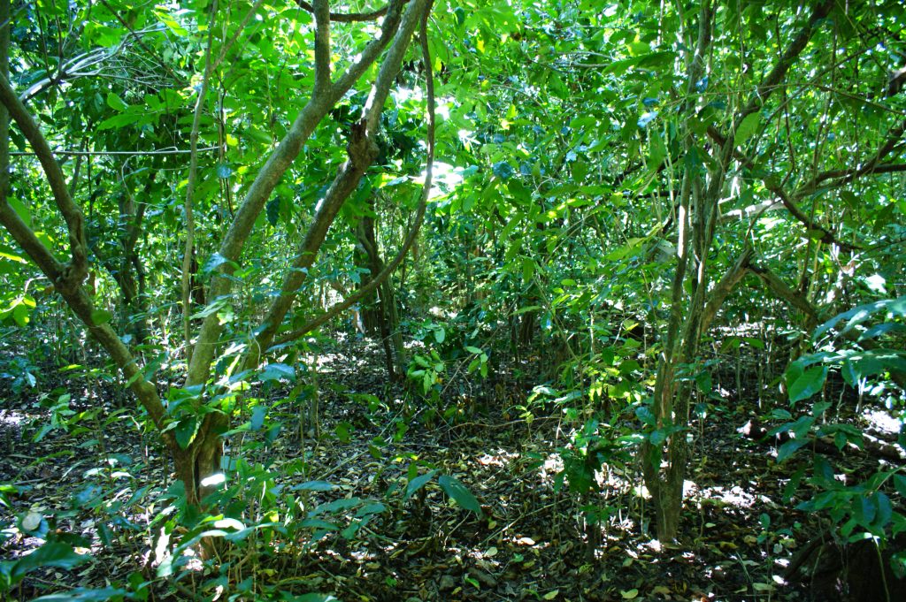
5. Managed forests functioned as productive landscapes, not “untouched” nature
In various areas of Amazon, scientists talk of forests being designed like orchards, fisheries and composted gardens- a strategy that doubts the distinction between urban and rural areas. Rather than depriving the land, these systems seem to have focused on selective cultivation and long-term productiveness producing traces of which can still be detected in the distribution of species today. This is important as it replaces the notion of sustainability as having a low human population to one of intentional stewardship that preserves biodiversity and sustains large populations. The forest is converted into a multi-layered utility in engineering terms, in terms of food-producing, source of materials and buffering of the climate and fire management integrated into settlement construction.
6. Firebreaks and perimeter works show hazard planning in the landscape
Other boundaries contain wide roads and perimeter ditch among other boundaries that are both circulation routes and buffers. Investigators in the Upper Xingu described fortified towns having wide roads, central plazas, and defensive trenches – features also serving as discontinuities in the flow of fuel. Individual sources record that police and visiting experts have analyzed archaeological data on towns having extensive roads and artificial firebreaks when developing plans on dealing with extreme conditions.
These characteristics emphasize the fact that ancient infrastructure was frequently multi-purpose, transporting traffic and drainage and serving the function of demarcation and mitigation of hazards with a single footprint.
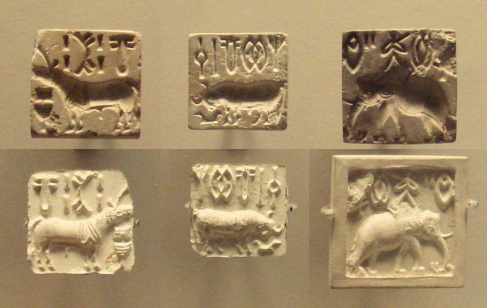
7. The hardest “technology” to recover is writing and that changes what can be proven
Assets of sophisticated record-keeping in rainforest environments have a preservation issue: perishable media disappear and even carved systems may be few without an extensive corpus. Efforts on uncracking scripts in other fields reveal that the volume reliance on decoding; certain ancient writing systems stagnated hundreds of years due to the limited number of inscriptions that could be compared. Even where sign lists are available, research on scripts like Linear Elamite shows the fundamental limitation the absence of sufficient repeating sequences makes it hard to verify grammar, names, and meanings on a large scale (even when sign lists are available).

This is why the problem solving in Amazon engineering is also more likely to be debated in terms of geometry, soils, and hydrology than in terms of texts. The environment constructed transforms into the record. A combination of these findings can also make the Amazon less of a lost city tale. They relate to a persistent tendency: systems of settlement, based on mapped movement, productions of soils, and waterworks that adjusted to seasonal volatility. The deeper takeaway is methodological as much as historical. In a landscape where stone is rare and forest regrowth is swift, engineering survives as subtle topography and modern tools are finally learning how to read it.

