_returns_to_the_General_Dynamics_Electric_Boat_shipyard")

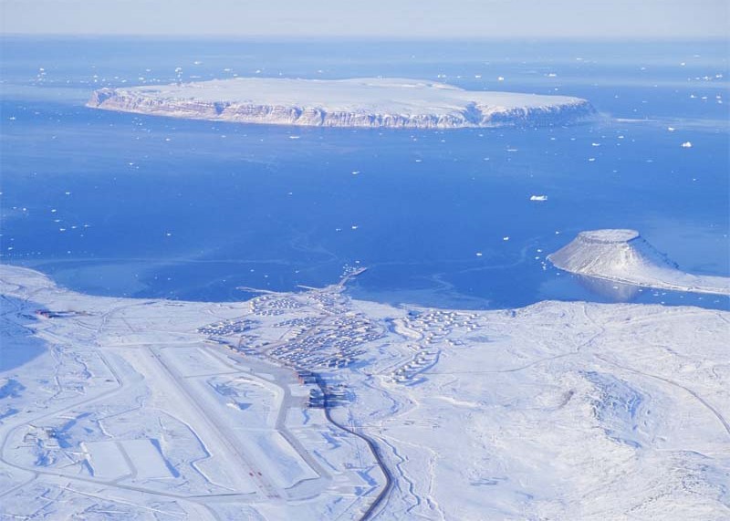
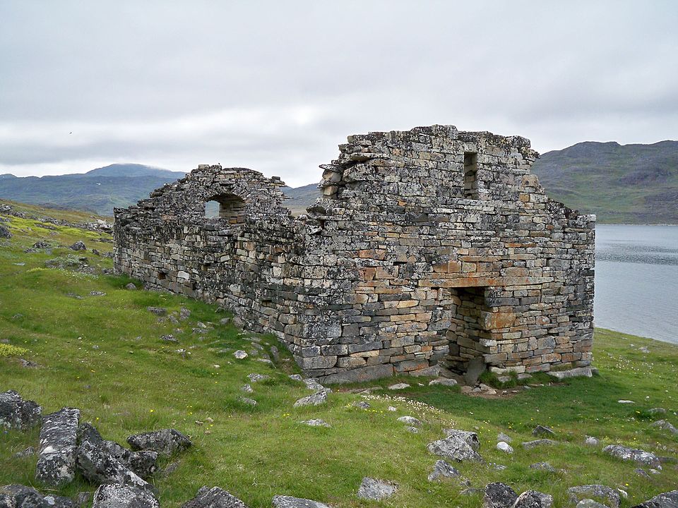
It was, according to then-U.S. Secretary of State Mike Pompeo, the question of whether a new South China Sea was being created in the far North: full of militarization, with competing territorial claims, which is how the far North became a systems-engineering problem.Greenland is in the middle of that issue. The largest island in the world is sparsely inhabited, not much more than 56,000 people, predominantly Inuit but covers air and sea geometry of interest to the defense of North America and North Atlantic shipping and the new industrial hunger of the 21 st century; that is, critical minerals.
That combination is why U.S. politicians and politicians such as President Donald Trump have positioned Greenland as something that the United States requires, despite the fact that the government of Greenland and that of Denmark have shunned U.S. ambitions and focused on local decision-making. To the readers of Modern Engineering Marvels the more robust narrative is not a bid, a slogan, but is rather the hardware, infrastructure and the operating constraints that render Greenland operationally consequential.
1. The shortest sensors and warnings lines in the Arctic
The latitude of Greenland is so compressive of distance as to make it one of the first places to be detected and observed. Matters of geometry have been significant since World War II, when the United States occupied Greenland to safeguard shipping lanes along the North Atlantic to prevent German dominance. It also matters due to the fact that the quickest paths to some of the long-range threats as well as the most efficient paths to space and missile surveillance lie at a high altitude over the pole.
The engineering implication is simple: when a defense architecture relies upon continuous sensing, the where can arguably be as significant as the what. The fact that Greenland is located above the arctic circle puts it within the thin band in which radars, satellite links and command networks will be able to project their coverage into previously difficult to track approaches.
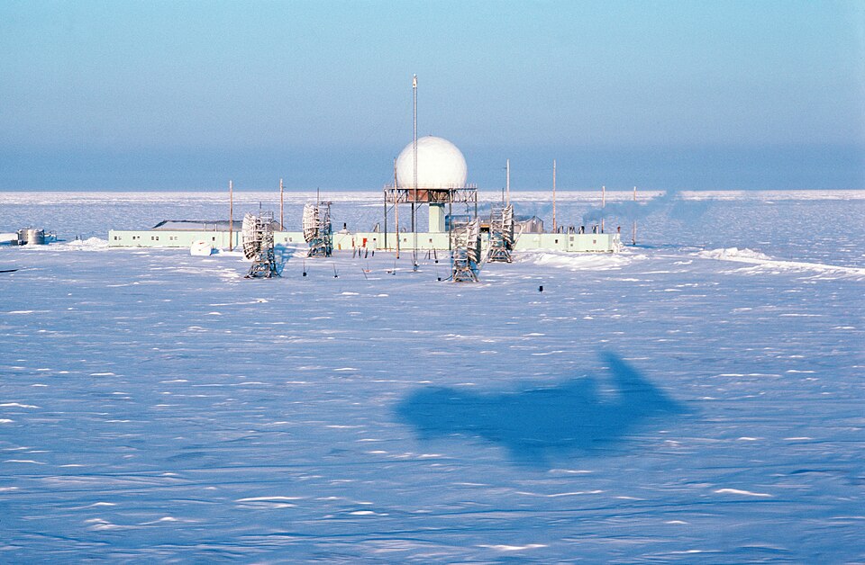
2. Pituffik Space Base as an arctic capable systems platform
Pituffik Space Base in northwest Greenland is a base of the U.S. Department of Defense built following an agreement between the U.S. and Denmark in 1951. It aids the missile warning, missile defense and space surveillance missions and is a combination of radar functionality, and satellite command and control access using one of the most austere environments in the U.S. basing network.
Any operation there is less about one radar but rather about uptime: logistics pipelines, cold weather maintenance, runway and fuel durability, and trained staff which can keep the operations going through extended stretch of darkness, ice and access limitations. The security narrative in Greenland is mostly based on the geopolitics, yet the status quo, in this case, is the ability of the platform to operate throughout the year without brittle supply chains.
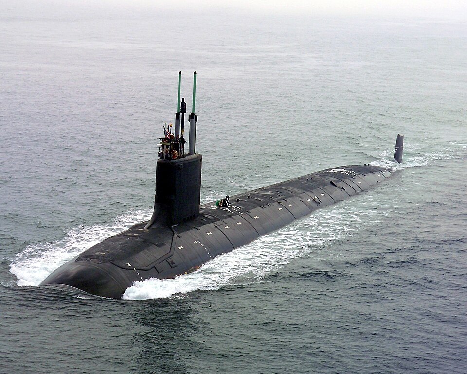
3. GIUK Gap as the problem of measures of chokepoint
The Greenland-Iceland-United Kingdom (GIUK) Gap is one of the corners of the Greenland-Arctic-Open Ocean route traversed in the North Atlantic and involved in watching the movement under the sea. The GIUK Gap is a limit in engineering terms: it reduces the choices available to submarines and national surveillance and antisubmarine warfare activity is concentrated into a narrow area.
The bounded space makes investment decisions. A surveillance plan may focus on installed sensors, patrol, air surveillance, or more recently autonomous systems. The strategic designation is ancient; the contemporary fact is a cyclic struggle between more silent mediums and enhanced sensibility, as well as communications connections that could endure rough oceans and elevated latitudes.

4. It is unmanned surveillance rather than an exception
Northern Atlantic Navies are also adjusting to the cost and availability constraints of traditional fleets by developing autonomous and unmanned surveillance ideas. An example is the Royal Navy of the UK, which has underscored a GIUK-centric plan encompassing the generation of unmanned technology that will be used to monitor undersea traffic, as a pressure on conventional frigate capability and the presence requirement of constant coverage.
It is not a gadget story, but an architecture story: distributed sensors, underwater men, and flying drones can increase dwell time, increase search quadrants and decrease risk to the crews. The difficult bit is integration – safe communications, data integration and operations concepts that perform even in bad weather, high sea state and with intermittent satellite reach. The geography around Greenland is also pertinent to Greenland because it is located beside the path through which the networks attempt to view.

5. Arctic buildout in Denmark focuses on surveillance
Denmark has sought to build capacity in and around Greenland and the North Atlantic more broadly on the basis of significant expenditure proposals, with a DKK 14.6 billion deal being previously announced and a more substantial plan of 2025 costing DKK 27.4 billion. The second agreement has clauses that sound more like a requirements document to stay constantly aware and secure logistics: Arctic-capable vessels, capacity of the maritime patrol aircraft, the increase in drones, and an air surveillance radar in eastern Greenland.
It also contains a new telecommunication subsea cable carrying Denmark and Greenland, and deep-sea exploration of monitoring important undersea infrastructure. The engineering lesson is that sovereignty and defense in the Arctic increasingly depend on connectivity and sensing-systems, which are capable of verifying what is occurring in extremely expansive areas with limited human activity.

6. Shipping lanes involve a stress test of border-control and infrastructure
Declines in sea ice due to climate have made trans-Arctic journeys, such as the Northern Sea Route and the Northwest Passage more interesting. Although some of the routes are still seasonal and hazardous, the trend of movement is obvious: the increased traffic, the increased uncertainty and increased necessities of ports, search-and-rescue capabilities, and enforcement equipment in the open sea.
That pressure alters the design of northern infrastructure by states. Detecting the presence of the unknown ships does not need to be a naval activity, it turns into a sensor-and-network issue involving coastal radar, satellites, patrol planes and legal restrictions to report and inspect. The absence of deep infrastructure in the Arctic renders every single new ship a marginal burden on communications, emergency response, and awareness of the maritime domain, precisely the areas that Denmark and NATO-aligned allies are currently investing in.
7. Minerals meet permitting, and the constraint is local governance
Greenland’s rare earth potential attracts sustained interest because these materials feed electronics, batteries, and other high-tech supply chains. But development is constrained by climate, logistics, and environmental rules, including Greenland’s 2021 ban on mining that releases radioactivity into the environment.In late 2025, an arbitration tribunal in Copenhagen ruled that a dispute tied to a rejected exploitation license must first be heard in Greenland’s courts, a decision described by Climate Rights International as strengthening local accountability. The claim sought approximately US $11.5 billion in damages and interestmore than ten times Greenland’s annual budgethighlighting how mineral projects in Greenland are governed as much by law and consent as by geology and processing technology.

The industrial story, in other words, runs through community decision-making as a hard project constraint. Greenland’s strategic pull comes from layered realities: polar geometry that favors sensing, a uniquely placed U.S. base with space and missile-warning roles, chokepoints that concentrate undersea monitoring, and an Arctic operating environment where communications and logistics can decide whether advanced systems actually function.For engineering and infrastructure watchers, the enduring question is how these systems are built, connected, and sustained without ignoring the people living on the island whose choices shape what can be deployed, where, and under what rules.”

