“A nuclear war cannot be won and must never be fought.” This dire admonition, repeated by Ronald Reagan and President Joe Biden, highlights a frightful fact though the threat of nuclear war is far-fetched, its effects would be apocalyptic for all reaches of the United States. However, as tensions are heating up in the world and headlines focus on fresh nuclear threats, an urgent question arises for those sensitive to geopolitics and readiness which countries have the best chances of survival in the event of the unthinkable?
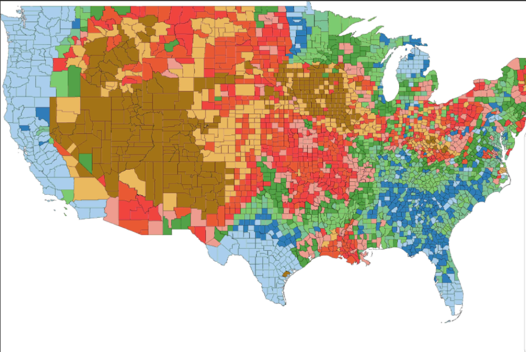
Recent simulations by scientists and fallout maps, as well as lessons learned from historical nuclear tests, indicate that geography, population concentration, and weather patterns can be a decisive factor. Certain states, because of where they are and their geography, are statistically less likely to be hit by initial blasts or the greatest levels of radioactive fallout. This listicle not only discusses the most likely states to ride out a nuclear storm, but also the science and strategy that determine their comparative safety.
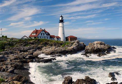
1. Maine: Natural Buffers and Low Population Density
Maine is one of the states least likely to suffer severe fallout in nuclear attack scenarios. It is situated far from the Midwest’s missile silo fields and does not have large military bases, so it is an improbable target. Cumulative doses of radiation between 0.001 and 0.5 grays were projected in fallout scenarios far from lethal levels, even in the most extreme cases. The state’s large forests and rural areas are natural shields, decelerating the dissemination of radioactive particles. The relative low population density of Maine also translates to reduced congestion in emergencies, increasing its emergency preparedness advantage. As fallout charts from recent scientific studies attest, New England generally, and Maine specifically, are safer refuges in a nuclear crisis.

2. Rhode Island: Few Targets and Controllable Fallout
Rhode Island’s relative smallness and absence of large military installations give it a special type of protection. The state has no nuclear power plant, only a small research reactor at the University of Rhode Island, with little danger compared to commercial plants. Fallout models project that Rhode Island would receive some of the lowest nationwide radiation doses, with levels far below acute health effect thresholds. Although no place is absolutely free from indirect effects like supply chain breakage or long-term pollution Rhode Island’s distance from preferred targets and its compact geography render it an obvious choice for those looking for a statistically safe place to go. As several expert studies pointed out, New England states such as Rhode Island always do the best in fallout simulations.

3. Michigan: The Great Lakes Shield and Northern Retreats
Michigan’s terrain provides a double shield its distance from potential strike zones and the natural shield of the Great Lakes. Fallout models indicate that the state would receive much less radiation exposure than areas in the direct fallout path from silo fields. Northern Michigan and the Upper Peninsula are safe locales remote from significant population clusters and strategic targets. Michiganders would still need to make initial fallout preparations, but the state’s combination of urban, suburban, and rural zones provides numerous sheltering opportunities. Michigan’s total radiation dose would still fall below lethal levels in both normal and worst-case scenarios, according to recent simulations.

4. Kentucky and Tennessee: Rural Strength and Natural Resources
Kentucky and Tennessee are advantaged by moderate population densities, vast rural areas, and comparative remoteness from major nuclear targets. Simulations suggest that these states would typically suffer less intense fallout than those nearer the Midwest’s missile silos. Kentucky’s natural resources particularly water and arable land may be essential for long-term sustenance following an attack. Tennessee’s Appalachian region naturally isolates and shelters, further decreasing chances of exposure. Although Tennessee has one nuclear power plant, it is less likely to be targeted if attacks are concentrated in silo fields. And as fallout maps attest, both states fall outside the areas of greatest danger, making them ideal candidates for survivalists.
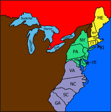
5. The Broader Safe Zone: New England and the Mid-Atlantic
Aside from the specific outliers, scientific fallout maps show a wide corridor of comparative safety running from Maine to New Jersey and the Mid-Atlantic. New Hampshire, Vermont, Massachusetts, Connecticut, New York, New Jersey, Pennsylvania, Delaware, and Maryland all have projected cumulative doses of radiation far below lethal levels in average-case scenarios. These locations are distant from the Midwest missile silos, and the prevailing winds decrease the chances for direct fallout. Specialists warn that even these regions would suffer severe indirect effects, such as food and water supply contamination, and the long-term societal effect of a nuclear war. As John Erath, the Center for Arms Control and Non-Proliferation’s Senior Policy Director, explained to Newsweek “Nowhere is truly ‘safe’ from fallout and other consequences like contamination of food and water supplies and prolonged radiation exposure.”
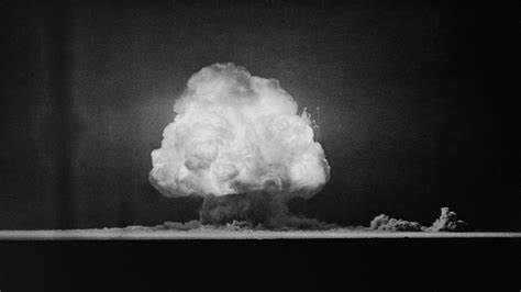
6. The Trinity Test: Fallout’s Unpredictable Reach
History puts any nuclear safety discussion into perspective. The Trinity test in 1945, simulated in unprecedented fidelity by Princeton University researchers, showed radioactive fallout travels much farther and more erratically than was realized. Employing cutting-edge weather modeling, scientists calculated that fallout from the initial atomic blast covered as far as Lake Crawford in Canada in a matter of days, creating a lasting geological imprint. New research also pinpointed U.S. areas e.g., Utah, Nevada, Wyoming, Colorado, Arizona, and Idaho that were heavily contaminated with low levels of fallout far from the test site. This highlights an important fact
weather patterns, terrain, and weather conditions can make radiation shadows and corridors, making any guesses on which regions are safe a problematic exercise. As the Princeton researchers indicated, these results “offer a chance to re-examine the public health and environmental impact of atmospheric nuclear testing.” Their maps of high-resolution fallout challenge assumptions and underscore the importance of continued vigilance.
7. The Midwest and Mountain West: High-Risk Areas
Although statistically safer are some states, others are confronted with far more risks. The Midwest states of Nebraska, Montana, North Dakota, Colorado, South Dakota, Iowa, and Minnesota are home to most of the U.S. missile silo complexes and would surely be hit in any nuclear war. Fallout modeling estimates these could receive cumulative doses of radiation from 1 Gy to a mind-boggling 84 Gy, many times the lethal dosage. Scientific American’s analysis determined that a strike in this area would “annihilate all life in the surrounding areas and sully fertile farmland for years.” Likewise, areas of the Mountain West, such as Wyoming and Idaho, have been found to receive unexpectedly high fallout due to past wind patterns and terrain. These conclusions reaffirm the somber truth that geography is both a shield and curse in the nuclear era.
The science of nuclear fallout is intricate, influenced by geography, weather, and the immutable logic of war. Whereas some states possess statistical strengths due to their geography, natural defenses, and lower population densities experts concur that no state can be safely immune from the domino effects of nuclear war. As fallout models and history itself demonstrate, the greatest defense is still prevention, not preparation. But for those set on preparing for the worst, grasping the science of survival probabilities is the first step in a universe where the only guarantee is uncertainty.

