
“Two meters of sea level rise in minutes. Why aren’t we discussing that more?” asks Virginia Tech study author Professor Tina Dura. As sea-level rise and global warming sweep the coastal hazard debates, a much more local and catastrophic hazard lies just offshore from the Pacific Northwest: the Cascadia Subduction Zone. This 600-mile fault has been resting menacingly inactive for more than three centuries, yet in a recent study, its next convulsion was found potentially to unleash a series of catastrophes greater than anything contemporary America experienced. Scientists now warn that a mega-tsunami, caused by an earthquake of 8.0 or greater, would devastate massive areas, redrawing coastlines, highways, and villages in a matter of minutes.
Here, the most pressing facts and discoveries of new research come together to shed light on the actual magnitude of this threat and what it all means for the citizens and workers who inhabit and labor along the Pacific rim.
1. The Cascadia Subduction Zone:
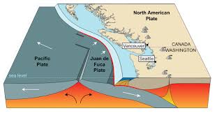
A 15% Probability of Rupture Sleeping Giant It stretches from northern Vancouver Island to Cape Mendocino, California, a 600-mile-long megathrust fault on which the Juan de Fuca Plate is being forced underneath the North American Plate. This tectonic plate boundary produces some of the largest earthquakes in the world but has not ruptured since 1700. The US National Seismic Hazard Model estimates a 15% chance that an earthquake measuring 8.0 or greater will occur along this fault within the next 50 years (US National Seismic Hazard Model). Its latest large event, of around size 8.7 to 9.2, left geologic imprints for monumental land subsidence and drowned marshes throughout the Pacific Northwest. This extended duration of seismic quiet can only increase the chances of a future major rupture.
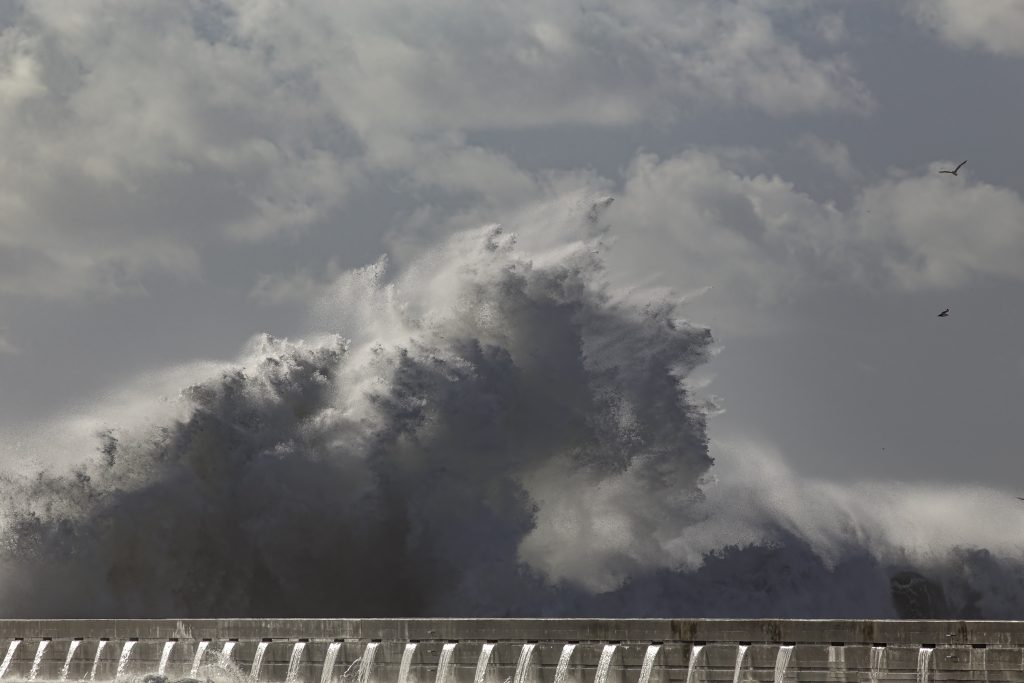
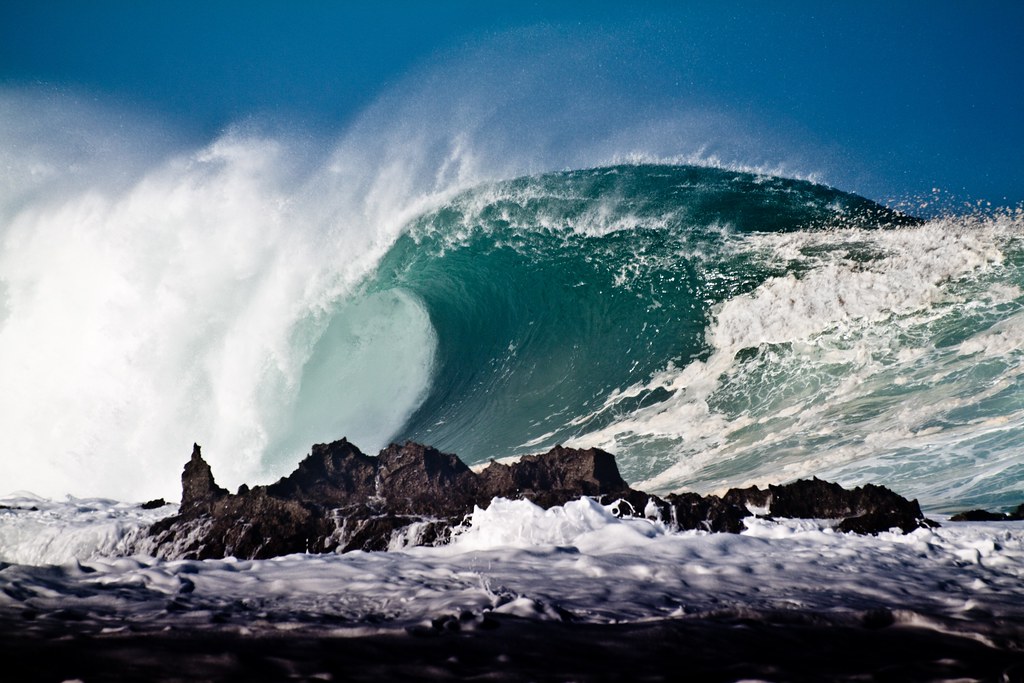
2. Mega-Tsunami Energy:
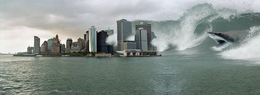
Waves as High as 1,000 Feet The Cascadia earthquake mega-tsunami would unleash waves of 1,000 feet high down the coast (Virginia Tech study). The waves would be triggered within minutes of the earthquake with scant chance for evacuation or mitigation. The power of this tsunami would devastate cities, reduce infrastructure to rubble, and forever change the landscape.
As this paper acknowledges, “Unlike slow, climate-related events, the land subsidence and flooding resulting from a Cascadia earthquake would occur in minutes without time for adaptation or mitigation.”
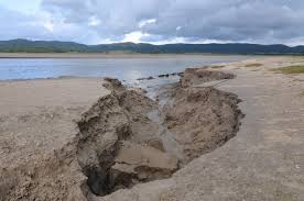
3. Sudden Coastal Land Subsidence:
6.5 Feet in Minutes One of the most underestimated threats is sudden coastal land subsidence. New studies indicate that a major Cascadia earthquake would drop coastal ground as much as 6.5 feet (2 meters) in seconds (USGS study). This instantaneous displacement would significantly expand floodplains, dropping previously considered out-of-the-way neighborhoods solidly into the path of immediate and prolonged flooding. As Professor Dura explains, “We talk about climate-driven sea level rise, which is occurring at three to four millimetres a year, and that does eventually add up. But here we’ll have two metres of sea level rise in minutes.”
4. The Compound Menace:
Earthquake, Tsunami, and Climate Change The dangers do not stop with the first quake and tsunami. The researchers at Virginia Tech concluded that with global warming sea-level rise expected to happen, an impact of a Cascadia event would be potentially even more catastrophic than presently estimated (USGS study). Floodplains in the year 2100 would be three times wider, putting another 22,500 buildings, 14,350 people, and over 1,250 kilometers of highways at risk of permanent flooding (Climate Fact Checks). This dual risk increases the urgent need to include earthquake-induced subsidence in coastal planning and disaster risk reduction.
5. Regions of Highest Risk:
Seattle, Hawaii The most severe impacts are predicted for southern Washington, northern Oregon, and northern California, with heavy populations and important infrastructure located directly above or next to the most hazardous areas of the CSZ (The Independent). Alaska and Hawaii, as well as the farther distance from the fault, are also threatened due to their seismic and volcanic record. Hawaii also has a recorded history of collapse tsunamis produced by volcanic collapse, and volcanoes such as Mauna Loa and Kilauea are still threats (New York Post).
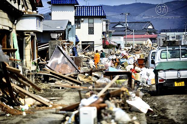
6. Infrastructure and Economic Fallout: Billions at Stake
The colossal Cascadia event would cause unparalleled destruction to infrastructure and the economy. FEMA’s 2022 simulation projected 5,800 deaths from the earthquake itself and an additional 8,000 from the tsunami, and more than 618,000 structures more than 2,000 schools and 100 essential facilities destroyed or damaged (Times of India). The total economic loss would be estimated at $134 billion. Saltwater intrusion may contaminate cropland, wetlands may get flattened, and essential services may get cut off for years.
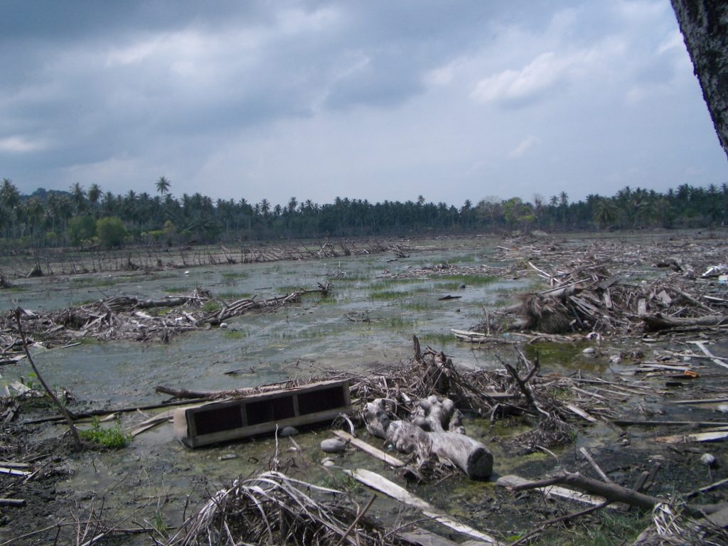
Image Credit to Flickr – License details
7. The Permanent Mark:
Lasting Coastal Transformation The effects of a mega-tsunami and subsidence would remain for decades or centuries. Townships in general would be altered to tidal mudflats, with permanent inundation being the new norm. As Dr. Tina Dura warns, “This less-well-discussed threat is going to last for decades or centuries after the earthquake.” Coastal developers must now factor in not just the initial loss, but replanning of the shoreline for decades to come and must relocate or re-build infrastructure (NBC News).
8. Obsolete Risk Maps and the Need for New Readiness
Current maps of flood and tsunami do not sufficiently recognize the combined impact of sinking ground and rising sea level. Failing to do so can leave citizens vulnerable, woefully unprepared. The Virginia Tech report calls for new estimates of hazards, updated evacuation paths, and stronger building regulations (Times of India). Education, early warning systems, and disaster-resilient infrastructure play critical roles in reducing the scale of disaster when and not if the next Cascadia event occurs.
9. Historical Disasters in Global Perspective
History in Indonesia, Japan, and Chile shows how subsidence caused by earthquakes has the potential to lead to land loss and permanent flooding (Climate Fact Checks). The 1960 Chile earthquake, for example, produced 2.5 meters of coastal subsidence, permanently flooding fields and forests. The Cascadia scenario is not unique other subduction zones around the world are just as threatened by compound hazards, with global importance in the combination of seismic and climate hazards in coastal management. The Cascadia Subduction Zone hazard is both short- and long-term, from the immediate severity of the mega-tsunami to the long-term hazard of repeated flooding and long-term loss of land. For geologists, engineers, and emergency planners, the message is plain and firm: planning must meet the standard of this threat’s scale and sophistication. In the words of Professor Dura perfectly, “Knowing what to expect is the first step toward saving lives and protecting the environment.” The time to act is now, before the next catastrophic rupture redescribes the Pacific coast and history itself.

